You do not need the same kind of hike every day on the Central Coast. Some mornings call for a climb with a view across San Luis Obispo. Others are better spent walking a boardwalk or following the coastline with frequent stops.
Use this guide to choose a route that fits your day. Distances are approximate and vary with your starting point. Check the current trail map, weather, and closures before heading out from Nightsky Camps.
Bishop Peak for a rewarding climb
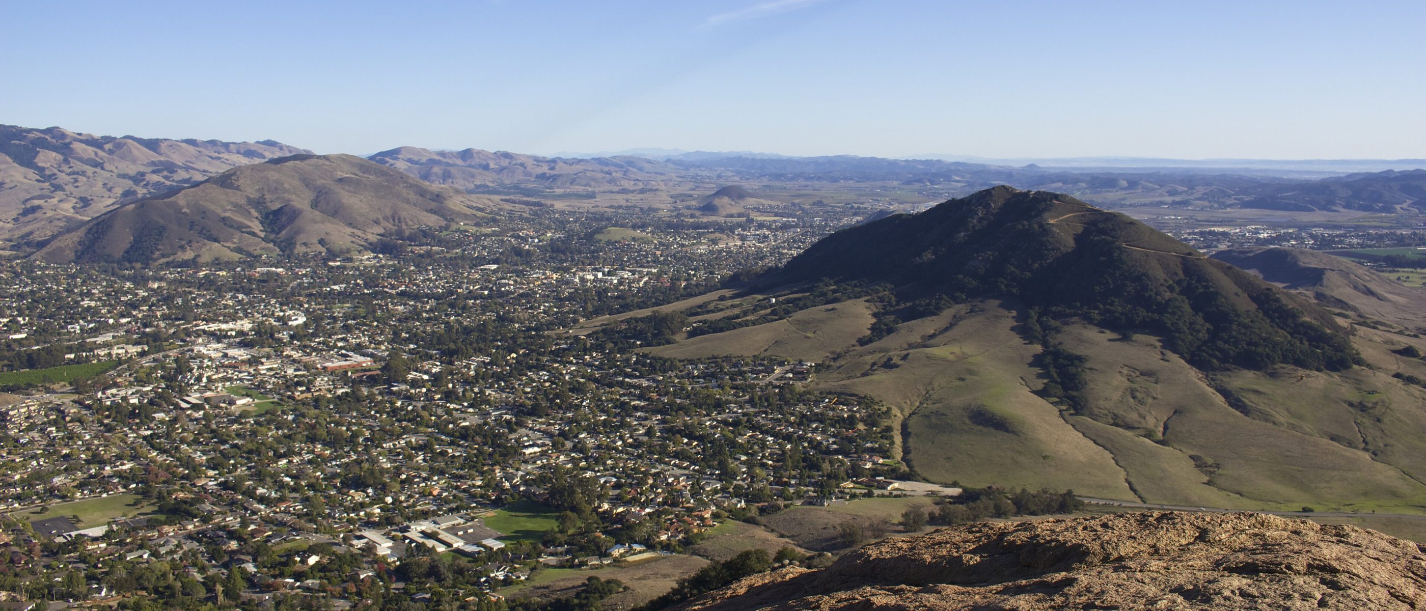
Bishop Peak is a strong choice when you want your walk to be the main activity. SLO County Parks describes the Patricia Avenue route as approximately four miles round trip, with a sustained climb and views across the city and toward the coast on a clear day.
Wear shoes with reliable grip and bring water. The upper trail is rocky, so leave time for a careful descent and do not feel obliged to scramble onto summit boulders.
Best pairing: breakfast before the hike and a relaxed downtown lunch afterward.
Felsman Loop for a shorter foothill outing
If you want the Bishop Peak landscape without the full summit route, look at Felsman Loop. County Parks lists the loop itself at about 1.7 miles, with easy to moderate terrain. Your total walk depends on the approach you use.
Consult the city’s Bishop Peak map before choosing a trailhead. This is a useful option when your group wants a shorter outing, but it is still an uneven dirt trail.
Best pairing: a morning walk followed by time in San Luis Obispo.
Bluff Trail for ocean scenery
At Montaña de Oro State Park, the Bluff Trail offers approximately 3.4 miles round trip along the coast. Its relatively gentle profile makes it appealing when you want views without a summit climb. You can turn around earlier for a shorter walk.
Allow extra time for viewpoints and keep away from cliff edges. Follow posted closures instead of using informal paths toward coves. State Parks currently reports a closure at Corallina Cove access, a reminder that shoreline routes can change.
Best pairing: lunch in Los Osos or Baywood after the walk.
Valencia Peak for a longer uphill effort
For a more demanding Montaña de Oro outing, consider Valencia Peak. Local tourism guidance describes roughly 4.5 miles round trip and about 1,275 feet of climbing, depending on the route. Review the park map before setting out.
The exposed terrain calls for sun protection, water, and a wind layer. Choose a clear forecast if views are your main motivation. Clouds can change the experience, and there is no need to push for a summit in poor conditions.
Best pairing: keep the rest of the afternoon open after this hike.
Elfin Forest for a short boardwalk walk
The Elfin Forest in Los Osos offers an approximately 0.8-mile boardwalk outing. It is a good choice for a gentler morning or for travelers who would rather focus on the landscape than cover a long distance.
Stay on the designated route to protect sensitive habitat. If step-free access is essential, verify the approach, parking, and current boardwalk condition before leaving.
Best pairing: a Baywood meal and a look across the estuary.
Bob Jones pathway for an easy paced outing
The Bob Jones pathway near Avila Beach is a paved option shared by walkers, runners, and cyclists. Choose your turnaround to suit the time you have. Check the county trail information for your intended section and starting point.
Keep to the right, give others room to pass, and stay attentive at crossings. A paved route still benefits from comfortable shoes and water.
Best pairing: lunch and waterfront time in Avila Beach.
Before you head out
Bring layers, water, sun protection, and an offline map. Respect residential parking and avoid muddy trails when they are vulnerable to damage. Dogs are not allowed on Montaña de Oro trails; check the rules for every destination before bringing one along.
Plan your stay at Nightsky and leave room for a different kind of walk each day.